| Martin Hockey's Walk from Oxford to Land's End |
Oxford to Poole (9 to 16 June 2006)
South Devon (22 to 27 June 2006)
Cornwall (27 June to 7 July 2006)
Poole to Exmouth, 16 to 22 June 2006
The South West Coast Path, the longest National Trail in the UK, starts where the Sandbanks ferry puts in at South Haven Point. I followed the signpost (630 miles to Minehead) along the beach. The trail leads almost at once through a nudist beach - signs at the end warned you to put your clothes back on (but there was no sign at the beginning to tell you to take them off). At Studland the path leaves the beach for the chalk downs at Old Harry, where the geology students were out in force. Then the first of the coast path's many climbs, over Ballard Down to Swanage, a seaside town with plenty of history and, more immediately important to the long distance walker, plenty of B&Bs and fish and chip shops.
The hard work starts past Swanage. It was good to be back to classic coast path walking west of Durlston Head, surprisingly remote territory along the cliffs past Tilly Whim Cave and Dancing Ledge. From St. Aldhelm's Head there were three deep valleys and steep climbs out in as many miles. I was pretty tired by the time I reached Kimmeridge Bay, from where I climbed up to a great welcome at the 16th century Blackmanston Farm at Steeple (obvious how it got that name).
Next day was
Sunday - significant because that is one of the days when the next stage of the
coast path through the Lulworth army ranges is open.  It's
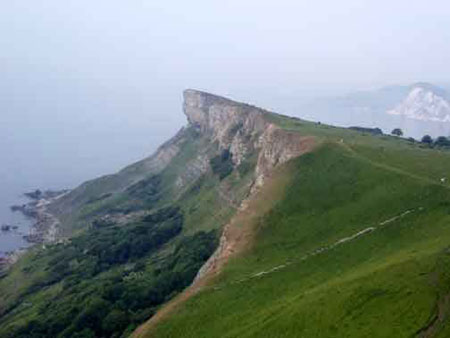
one of the most spectacular sections of the coast path, with steep ups and downs.
A bonus was the flora - orchids and other wildflowers right on the path, growing
where no walkers are allowed to pass on 5 days out of 7. But it was sad to pass
the remains of ancient buildings abandoned in 1943 when the army moved in.
Lulworth Cove was busy, but past Durdle Door the crowds thinned out. Then more spectacular walking though Thomas Hardy country, far from the madding crowd, to the end of the chalk at Osmington, followed by more mundane walking on the approach to Weymouth. Susan had driven down to see me, and we stayed at a guesthouse in Weymouth.
Weymouth was a nice enough town, but the stretch to Ferrybridge was rather tedious. I took the path round the inland edge of the Fleet, the stretch of salt water between Chesil Beach and the mainland. From a hill above Abbotsbury I could see the massed swans at the ancient swannery. Then it was easy flat walking along the coast to Burton Bradstock.
Day
11 started easily enough to West Bay,
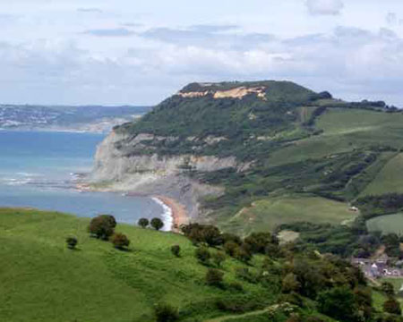
Bridport. Then I had a couple of climbs, first up Thorncombe Beacon, then Golden
Cap, the highest point on the south coast of England. This is a part of Dorset I know well, and I have many happy memories of walks
along the coast. But the Dorset coast is very prone to landslips, which sometimes
close the path. Between Charmouth and Lyme Regis, a landslip has closed the path,
and I was forced inland for a few miles. Then from Lyme a complete change of scene.
For 6 miles the path followed the Undercliff, a jungle of trees through the debris
of ancient landslips. It was rather eerie, and I felt quite relieved to emerge
at the other end above Seaton.
There was more good walking next day past Beer and Branscombe to Sidmouth - a rather more genteel place than most along this coast, and the start of easier country. Past the curious rocks offshore from Ladram Bay, I reached the mouth of the River Otter. It was low tide, and I was tempted to wade across, but I heeded the warning notice and slogged the extra 2 or 3 miles up to the bridge and back to Budleigh Salterton. Next morning, it was an easy couple of hours along the coast to Exmouth.
| Home | Diary | Picture Gallery | Log | Map | Practicalities | Links Updated November 2006. Copyright © Martin
Hockey 2006. email: mhockey29@gmail.com |